
Dushanbe uses geoanalytics to plan new schools and clinics
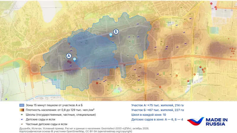
Dushanbe is employing geoanalytics to identify optimal locations for new schools and clinics in rapidly developing microdistricts. This data-driven approach helps city planners assess actual accessibility and population needs, moving beyond guesswork to ensure social infrastructure keeps pace with housing construction.
Read the full article at Avesta.tj →
Headline and summary written by daryo. The full report belongs to Avesta.tj.